
Search Hedgesville Property Records Through Berkeley County
There is no standalone town archive for Hedgesville land records. Title, assessment, taxes, and parcel mapping all run through Berkeley County systems instead. Start with a property address in the West Virginia Property Assessment search. Note the district and parcel number it returns. That identifier unlocks the County Clerk’s deed index and the Sheriff’s tax inquiry. Berkeley Online adds a GIS view of the lot. Permit and zoning questions, though, follow the Town of Hedgesville’s own administrative path.
- Find the address in the Berkeley County assessment search and record its owner, district, and parcel fields.
- Use the County Clerk electronic index to review conveyances and match the legal description.
- Check the Sheriff tax inquiry for the applicable ticket and paid or unpaid status.
- Compare the parcel in Berkeley Online with the town boundary; a postal ZIP is not enough.
- Ask the Town about building permits, business licenses, or zoning forms for a parcel within its jurisdiction.
The Berkeley County property-search guide walks through each county search field and what it returns. For any parcel in or near Hedgesville, deed and tax history still belongs to the county, while the town keeps only its local application paperwork.
Where Hedgesville Property Records Are Kept
Berkeley County holds the deed books, assessment roll, tax tickets, and GIS parcel layers for properties in and around Hedgesville. Each office owns a slice. The County Clerk records deeds and plats. The Assessor keeps parcel-account and value data. The Sheriff’s Tax Office reports ticket status. Town records are narrower: the Town Clerk and municipal offices manage local forms, business licenses, and building-permit steps. Knowing the custodian saves you from asking the town for a county deed or the Clerk for a permit application.
Berkeley County Records (deeds, taxes, parcels)
County offices hold deeds, parcel assessment data, tax status, and maps for Hedgesville-area properties.
Hedgesville Town Forms & Permits
105 Potato Hill Street
Hedgesville, WV 25427
304-754-4827
Hedgesville Property Records and Town Limits
A town name and a ZIP code cannot settle municipal jurisdiction. ZIP code 25427 reaches well past incorporated Hedgesville. A mailing label never proves a parcel falls under town permitting or zoning. Confirm the boundary through an official municipal source. Or contact the Town with the street address and the Berkeley County parcel identifier. This matters most along the roads toward Skinners Gap and North Mountain. Neighboring places may share the postal name there without sharing town status. Berkeley County’s tax map can place a parcel relative to the town. Treat its lines as reference only, not legal boundary evidence. Ask the Town directly whether its process applies. Do not assume a permit, license, or local fee is required before that answer.
Hedgesville Property Records Reflect a Long Town History
Hedgesville’s town layout dates to 1832. A Virginia act of February 11, 1836, addressed incorporation. The West Virginia Blue Book lists 1854 as the incorporation date. Those dates answer different historical questions. Collapsing them into one founding event would invent a fact nobody recorded. For a specific lot, the recorded deed and plat matter far more. They show how the land was actually described and conveyed. The old Warm Springs Road is now West Virginia Route 9. That renaming can shift how historic references line up with modern addresses. An older deed may use the earlier road name. Search both the historic wording and the current address. Then compare legal descriptions instead of trusting a street-name match alone.
The Berkeley County history of its municipalities adds historical context on Hedgesville’s town records.
Historical dates frame an old deed, but a filed conveyance and legal description identify the parcel.
Place and Plat Clues in Hedgesville Property Records
The town publishes no official list of neighborhoods or subdivision names. Treat any place label you meet as geographic context only. Never enter a descriptive label as though it were a recorded plat. A subdivision name, lot number, road reference, or survey should come straight from the deed or plat tied to the parcel.
| Neighborhood / Subdivision | Era | In the Records |
|---|---|---|
| Historic town layout | Laid out in 1832 | Check deeds for lot and road references. |
| Warm Springs Road corridor | Historic road name; now WV 9 | Search both old and current road wording. |
| Skinners Gap / North Mountain context | Geographic references | Not a formal subdivision list; confirm exact plat. |
Use the recorded plat name or lot description as an extra clue in the Clerk's index. Then compare it with the current assessment parcel. An older deed citing Warm Springs Road is a historic locator. It is not a second modern address. The Berkeley County parcel map guide shows how to read map identifiers beside recorded legal descriptions. It also explains why GIS is never a boundary survey.
Historic District Context for Hedgesville Property Records
Hedgesville has a National Register historic district. The designation adds context to the town core. It replaces nothing. A parcel’s deed, plat, tax account, and current zoning determination still govern the land itself. For historic status or planned work, verify the property’s inclusion and any review requirements with the responsible preservation or town authority. Never assume a Hedgesville mailing address places a property inside the district, or even inside the town. Historic-district boundaries and modern parcel lines answer different questions. A recorded deed traces ownership. A parcel map locates the site. A preservation boundary marks a review area. Check the right layer or office for each question rather than treating one map as an all-purpose record.
Hedgesville Town Permits Use Forms and Direct Contact
Hedgesville handles two local processes. These are building permits and business licenses. The town document page supplies the forms. Applications go by mail or in person. The town offers no parcel-level permit-results database online. Before submitting anything, ask the Town to confirm the current form version, supporting documents, fees, and whether your parcel even sits inside town jurisdiction. Keep the completed application and the town's response. That paperwork is your direct record of the local process.
Reach Hedgesville at 105 Potato Hill Street, P.O. Box 83, Hedgesville, West Virginia 25427, telephone 304-754-4827, fax 304-754-8641. Give the street address and the Berkeley County parcel number when asking which form applies. For permit paperwork, rely on the town's published forms page. A county tax record is no substitute for a municipal approval.
Open the Town of Hedgesville forms and permits page for the local application process.
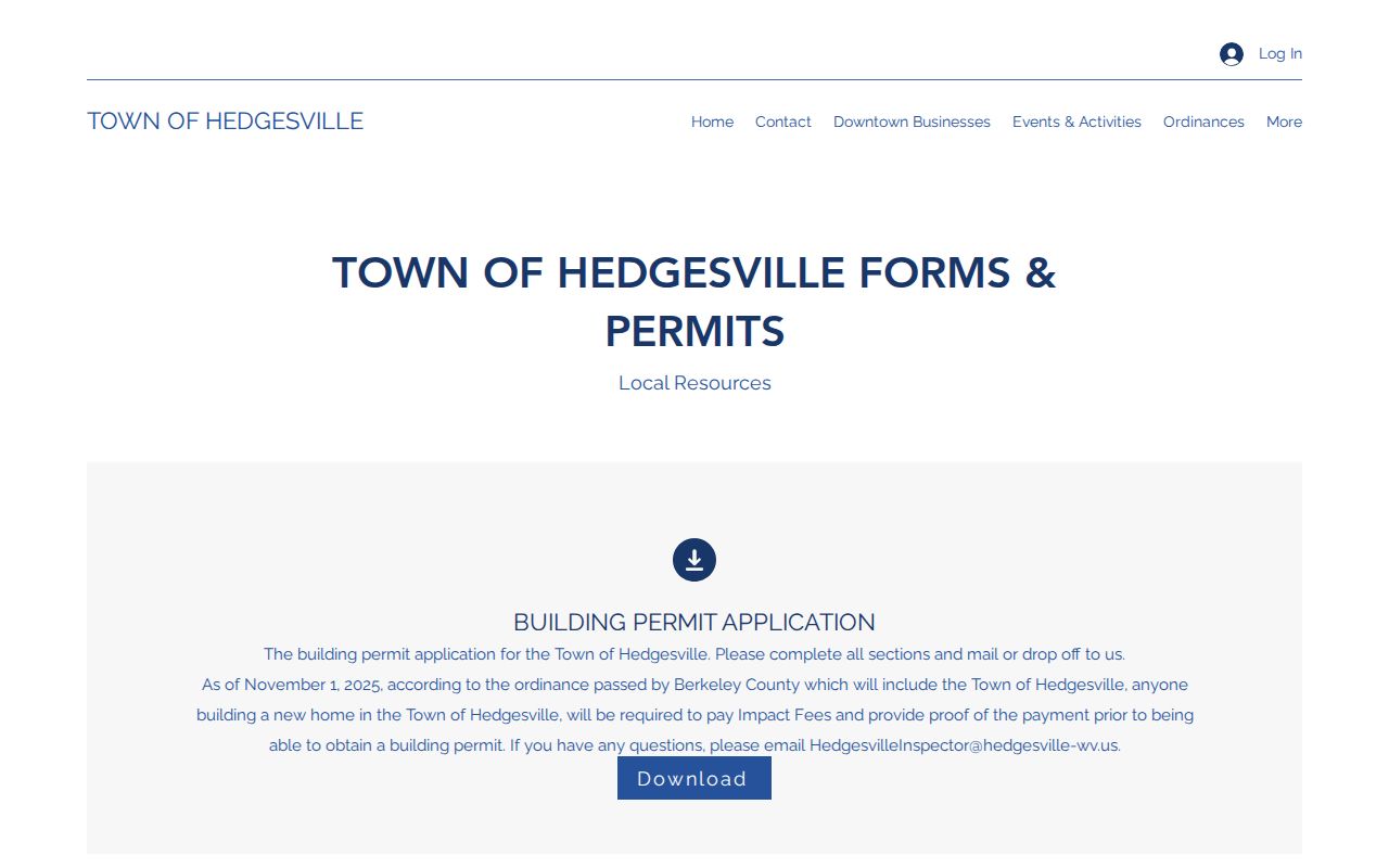
The town form page is the local application route. Berkeley County deed and assessment systems stay separate from it.
Berkeley County OneStop and the Hedgesville Impact Fee
Berkeley County OneStop handles county permit and planning applications, a different route from town forms. The portal sorts applications into categories and tracks their progress. It does not, however, publish a public index of every completed permit by parcel. A county notice dated November 1, 2025 states that new homes must show the Berkeley County impact fee has been paid. A building permit cannot be issued before that proof. Check both the county portal and the applicable municipal office. Confirm which agency's permit or fee applies to a particular lot.
Verify jurisdiction first for any project near town limits. A county application, a Hedgesville form, and an impact-fee proof are separate records. Each can belong to a different step in the same project. Save the application number and receipt. Later questions can then be tied to the correct office and the correct property.
Town forms and county application files are not interchangeable records. The Town can confirm which municipal form it accepts and how to deliver it. Berkeley County can explain its own portal status and fee steps. When asking either office to locate a file, be specific. Include the property address and the parcel number. Include applicant contact information and any prior permit reference.
Use Berkeley County OneStop to review county permit and planning categories for Hedgesville-area projects.
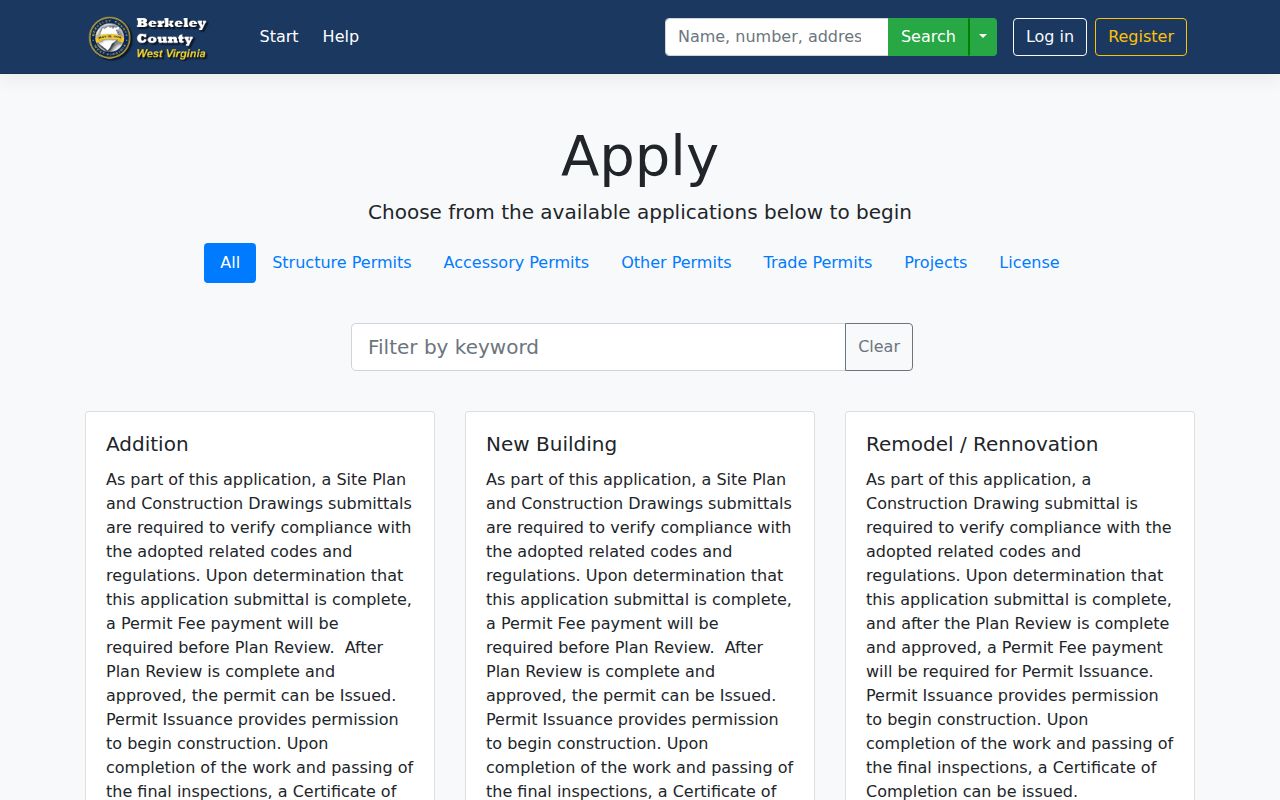
OneStop is the county's portal; Hedgesville's town forms page remains the route for town paperwork.
Assessment and Tax Records for a Hedgesville Parcel
Berkeley County assesses and taxes Hedgesville parcels. The county property assessment search displays the parcel and its value fields. The Sheriff's tax inquiry covers tax year and ticket suffix. It also shows whether the account is paid or unpaid. A 25427 postal address does not make the Town the custodian of these county records. If a value or tax account looks stale, contact the relevant county office. Provide the parcel number and assessment year.
The statewide framework generally assesses property tax at 60 percent of fair market value. That assessed figure is not a sale price. Nor does it prove a parcel lies inside Hedgesville. Follow the county account for tax questions. Follow the jurisdiction identified for your project when permits are the issue.
What Hedgesville Property Records Show and Their Limits
Hedgesville property records can show county assessment and tax data. They also include recorded deed history and parcel-map context. Town paperwork appears when the property sits within municipal jurisdiction. They cannot do everything. These sources do not prove a legal boundary. They cannot guarantee that every permit appears in a public database. They also do not establish current market value. Before making a property decision, compare the original deed, the current parcel account, and the relevant town or county record. A map line is orientation, not a survey.
Lawful use. Use public Hedgesville property information for ownership research, property diligence, and appropriate civic questions. Do not use an owner’s information to threaten, stalk, or harass a person.